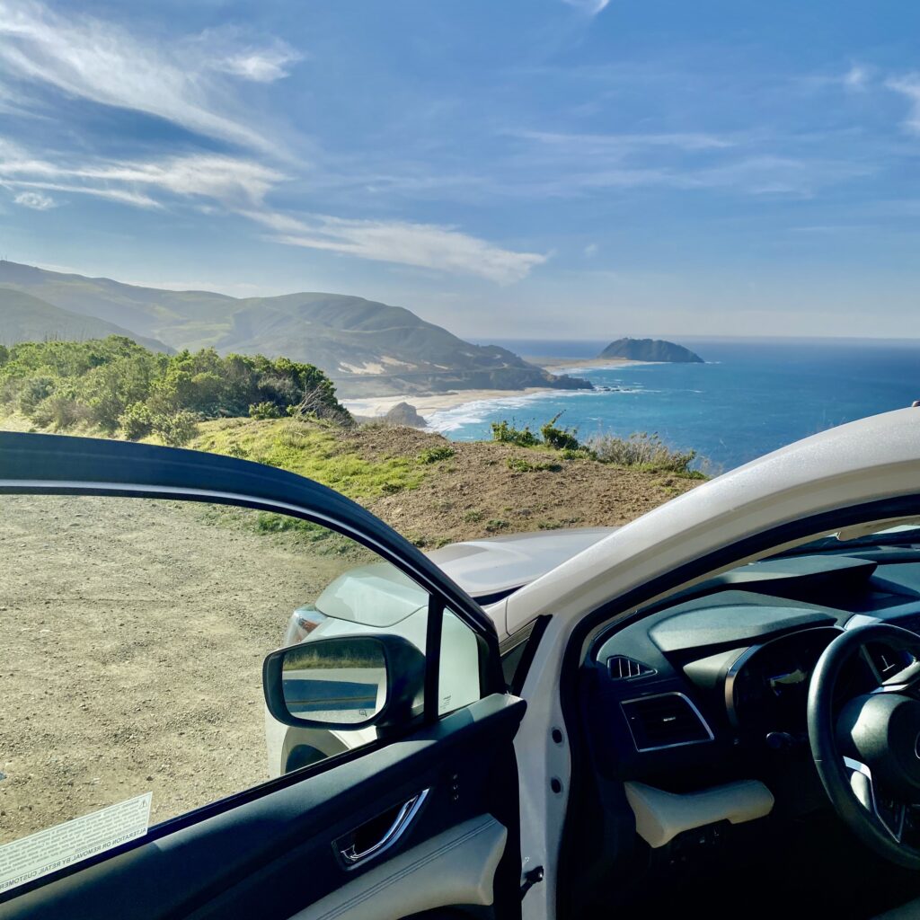
Driving along California’s Highway 1 through Big Sur is one of the most unforgettable road trip experiences in the country. The winding coastal highway passes dramatic cliffs, towering redwoods, secluded beaches, and breathtaking viewpoints overlooking the Pacific Ocean.
Stretching roughly 90 miles from Carmel-by-the-Sea to San Simeon, this section of California’s Central Coast offers incredible scenery around nearly every bend. Whether you’re planning a full-day adventure or simply looking for the best places to stop and take photographs, there’s no shortage of memorable destinations.
In this guide, we’ll explore the best Big Sur scenic stops along Highway 1, traveling from north to south, with recommendations for viewpoints, photography, parking, and making the most of your coastal drive.
Planning Your Big Sur Scenic Drive
Before hitting the road, here are a few things to consider when planning your trip.
- Starting point: Carmel-by-the-Sea, California
- Ending point: San Simeon, California
- Distance: Approximately 90 miles
- Driving time: Around 2.5–3 hours without extended stops, when the highway is fully open
- Recommended time: A full day, or two days for a more relaxed experience
- Best time to visit: Spring and fall generally offer a good balance of pleasant weather and lighter crowds
While the entire drive can be completed in a few hours, plan at least 6–8 hours if you want to stop for photographs, explore viewpoints, and enjoy some of Big Sur’s remarkable scenery.
Important: Highway 1 is vulnerable to landslides, wildfire closures, and construction delays. Always check Caltrans QuickMap before traveling, particularly if you’re planning to drive the entire route from Carmel to San Simeon.
Best Big Sur Scenic Stops: North to South
1. Point Lobos State Natural Reserve
Best for: Coastal scenery, wildlife, and short nature walks
Located just south of Carmel-by-the-Sea, Point Lobos State Natural Reserve is an excellent place to begin your Big Sur adventure.
Often described as one of California’s most beautiful coastal reserves, Point Lobos features rocky coves, wind-sculpted Monterey cypress trees, turquoise waters, and walking trails with spectacular ocean views.
Highlights include Cypress Grove, Sea Lion Point, and China Cove. Depending on the season, you may spot sea otters, harbor seals, and migrating whales.
Photography tip: Visit early in the morning for softer light and fewer visitors. China Cove and the Cypress Grove area offer particularly beautiful coastal compositions.
Parking tip: Paid parking is available within the reserve, but spaces are limited and may fill early, especially on weekends. Arrive early and follow posted parking instructions.
Suggested stop: 45–90 minutes.
2. Garrapata State Park and Soberanes Point
Best for: Rugged coastal cliffs, wildflowers, and panoramic ocean views
Continuing south, Garrapata State Park offers some of the most dramatic coastal scenery along Highway 1.
Unlike some of Big Sur’s more famous attractions, Garrapata provides an opportunity to explore rugged coastal bluffs and scenic trails without necessarily committing to a long hike.
Soberanes Point is a particular highlight. The coastal paths offer sweeping views of the Pacific Ocean, rocky headlands, and waves crashing against the shoreline.
During spring, wildflowers can add vibrant colors to the surrounding hillsides.
Photography tip: Soberanes Point is especially beautiful in late afternoon when the sunlight illuminates the coastal cliffs.
Parking tip: Look for designated roadside parking areas near the numbered Garrapata access gates. Gates 8, 9, and 10 provide access to the Soberanes Point area. Avoid stopping in traffic or blocking the highway.
Suggested stop: 30–60 minutes.
3. Bixby Creek Bridge
Best for: Iconic Big Sur photographs and coastal landmarks
No scenic drive through Big Sur would be complete without experiencing Bixby Creek Bridge.
Completed in 1932, this magnificent concrete arch bridge stretches across a deep canyon overlooking the Pacific Ocean. It is one of the most recognizable landmarks along California’s Highway 1.
The combination of dramatic cliffs, coastal mountains, and the bridge’s graceful architecture makes this one of the most photographed locations in Big Sur.
Even if you’ve seen countless photographs of Bixby Bridge, experiencing it in person is something special.
Photography tip: The surrounding coastline and bridge are particularly beautiful during golden hour. For photography, use only overlooks where stopping is explicitly permitted, and consider coastal viewpoints farther from the bridge.
Parking tip: Parking and stopping are prohibited at both ends of Bixby Bridge. Do not stop on the bridge, make U-turns, or pull onto unsafe shoulders. Enjoy the crossing and continue to a designated legal viewpoint.
Suggested stop: 5–15 minutes at a permitted viewpoint, when available.
4. Hurricane Point
Best for: Sweeping coastal panoramas and landscape photography
Just south of Bixby Creek Bridge, Highway 1 climbs toward Hurricane Point, one of the most spectacular elevated viewpoints along the Big Sur coastline.
From this area, visitors can appreciate the vast Pacific Ocean, steep coastal mountains, and the winding highway as it follows the rugged shoreline.
Hurricane Point is especially impressive on clear days, when the coastal landscape seems to stretch endlessly into the distance.
Be prepared for strong winds, which are common at exposed locations along this part of the coast.
Photography tip: A wide-angle lens works particularly well for capturing the dramatic coastline and surrounding hills.
Parking tip: Stop only in an established, open turnout where parking is permitted and your vehicle fits completely outside the travel lanes. If no safe space is available, continue driving.
Suggested stop: 10–15 minutes.
5. Point Sur Lighthouse and Coastal Views
Best for: Coastal history, landscape photography, and unique landmarks
Farther south, one of Big Sur’s most distinctive landmarks rises above the coastline: Point Sur Lighthouse.
Perched atop a massive volcanic rock formation, the historic lighthouse has guided ships along this rugged stretch of California’s coast since 1889.
The surrounding landscape is beautiful, with rolling hills, open coastal plains, and the Pacific Ocean extending toward the horizon.
Visitors interested in history can explore the lighthouse through scheduled guided tours when available.
Photography tip: Capture Point Sur from a legal highway viewpoint, using the distinctive rock formation as the focal point of your composition.
Parking tip: The lighthouse is not an open-access roadside attraction. Follow the official instructions for guided tours and avoid entering restricted access roads.
Suggested stop: 10–15 minutes for roadside views; longer for a scheduled tour.
6. Pfeiffer Beach
Best for: Keyhole Rock, sunsets, and dramatic ocean scenery
Pfeiffer Beach is one of Big Sur’s most distinctive coastal destinations and a worthwhile detour from Highway 1.
Known for its unusual purple-tinted sand, powerful surf, and famous Keyhole Rock formation, the beach offers some of the most memorable photographic opportunities in the region.
Sunset is particularly beautiful when warm light illuminates the rock formations and surrounding coastline.
During certain times of the year, sunlight may shine directly through the opening in Keyhole Rock, creating a remarkable natural display.
Photography tip: Sunset is generally the most dramatic time to photograph Keyhole Rock. Bring a tripod if you enjoy long-exposure photography.
Parking tip: Access is via narrow Sycamore Canyon Road, and the beach has a limited paid parking area. Large vehicles may be restricted. The road can be difficult to navigate, so allow extra time and confirm access before departing.
Suggested stop: 45–90 minutes.
7. McWay Falls at Julia Pfeiffer Burns State Park
Best for: Coastal waterfalls and iconic Big Sur scenery
McWay Falls is one of Big Sur’s most famous natural landmarks.
Located within Julia Pfeiffer Burns State Park, the approximately 80-foot waterfall cascades from a coastal cliff into a secluded cove with turquoise waters below.
Surrounded by rugged cliffs and the Pacific Ocean, McWay Falls creates one of California’s most recognizable coastal scenes.
The combination of waterfall, cliffs, and ocean makes this location especially popular among landscape photographers.
Photography tip: Late afternoon light can illuminate the surrounding cliffs and provide beautiful contrast against the ocean.
Parking tip: The state park has a small paid parking area that can fill quickly. The Waterfall Overlook Trail has experienced extended closures due to infrastructure damage, so confirm current viewing access before planning your stop. Never attempt to reach the beach or waterfall directly; both are off-limits.
Suggested stop: 15–30 minutes if a designated public viewing area is accessible.
8. Limekiln State Park
Best for: Redwood forests, coastal scenery, and a peaceful break
South of the central Big Sur area, Limekiln State Park offers a different perspective on the region’s natural beauty.
Here, steep coastal mountains meet a forested canyon filled with redwoods, creating a refreshing contrast to the exposed cliffs and ocean viewpoints farther north.
The park also features historical lime kiln structures that reflect the area’s industrial past.
Limekiln is a worthwhile stop for travelers who want to experience Big Sur’s forests in addition to its coastline.
Photography tip: Forest scenes work especially well in soft, overcast light, when shadows are less harsh.
Parking tip: Day-use parking inside the park is extremely limited. Parts of the park, including backcountry trails, may be closed for safety or restoration work. Check the latest California State Parks notices before visiting.
Suggested stop: 20–45 minutes, depending on accessible areas.
9. Ragged Point
Best for: Elevated coastal views and a relaxing roadside break
Approaching the southern end of Big Sur, Ragged Point offers one of the final dramatic coastal viewpoints before Highway 1 continues toward San Simeon.
The area is known for steep cliffs, sweeping Pacific Ocean views, and beautifully landscaped grounds near Ragged Point Inn.
It’s an excellent place to stretch your legs, enjoy the scenery, and take a break after navigating the winding coastal highway.
On clear days, the views extend far along the coastline, providing a fitting conclusion to the most rugged portion of the drive.
Photography tip: Late afternoon is particularly scenic, with warm sunlight illuminating the coastline.
Parking tip: Visitor parking is available at Ragged Point Inn for patrons and guests, subject to posted restrictions. Use only permitted spaces and respect the property.
Suggested stop: 20–30 minutes.
10. Piedras Blancas Elephant Seal Viewing Area
Best for: Wildlife photography and a unique coastal experience
As you approach San Simeon, the Piedras Blancas Elephant Seal Viewing Area offers a completely different kind of scenic stop.
This protected coastal rookery provides an opportunity to observe northern elephant seals resting, socializing, and breeding along the shoreline.
Depending on the season, visitors may see enormous adult males, mothers with pups, or younger seals resting on the beach.
The viewing area is one of the most accessible places along California’s Central Coast to observe these remarkable marine mammals in their natural habitat.
Photography tip: Bring a telephoto lens to photograph the elephant seals from the designated viewing platforms without disturbing them.
Parking tip: Free parking is available at the designated viewing area along Highway 1. Admission is free, and accessible viewing platforms are located near the parking area. There are no restrooms at the rookery.
Suggested stop: 20–40 minutes.
Tips for Driving Highway 1 Through Big Sur
A successful Big Sur road trip is about more than simply reaching each destination. A little planning makes the experience safer and more enjoyable.
Start Early
Leaving Carmel early in the morning gives you more flexibility for parking, sightseeing, and photography. Popular destinations tend to become busier throughout the day, particularly during weekends and summer.
Never Stop in the Road for Photographs
Highway 1 contains sharp curves, narrow shoulders, and sections with limited visibility. Only pull over where stopping and parking are legally permitted.
If you miss a viewpoint, continue to the next safe turnout rather than stopping suddenly or attempting an unsafe U-turn.
Fuel Up Before Entering Big Sur
Gas stations are limited along this stretch of Highway 1, and fuel can be expensive. Consider filling up in Carmel or another larger community before beginning your drive.
Download Offline Maps
Cellular service is unreliable throughout much of Big Sur. Download your route before leaving Carmel and save the locations of your preferred scenic stops.
Bring Layers and Comfortable Shoes
Weather along Big Sur can change quickly. Coastal fog, wind, and cooler temperatures are possible even during summer. A light jacket and comfortable walking shoes are useful throughout the year.
Respect the Landscape
Big Sur’s natural beauty depends on responsible visitors. Stay on established trails, avoid climbing over barriers, pack out your trash, and respect wildlife and private property.
Frequently Asked Questions About Big Sur Scenic Stops
What is the most scenic part of Highway 1 in Big Sur?
The stretch between Garrapata State Park and Julia Pfeiffer Burns State Park is particularly spectacular. Highlights include Bixby Creek Bridge, Hurricane Point, Point Sur, and the McWay Falls coastline.
However, the southern section near Ragged Point also offers unforgettable views of Big Sur’s rugged landscape.
How long does it take to drive Highway 1 through Big Sur?
Driving from Carmel to San Simeon generally takes around 2.5–3 hours without extended stops when Highway 1 is fully open. For sightseeing, photography, and short walks, allow at least 6–8 hours.
Can you see Big Sur’s scenic stops without hiking?
Yes. Many of Big Sur’s most impressive views can be enjoyed directly from Highway 1 or from designated roadside viewpoints. Longer walks are optional at many locations, although some attractions require short walks or detours.
Are Big Sur scenic stops free?
Many roadside viewpoints are free. However, state parks, beaches, and certain attractions may charge entrance or parking fees. Always review posted requirements before parking.
What is the best time of year for a Big Sur scenic drive?
Spring and fall are excellent times to explore Big Sur. Spring often brings green hillsides and wildflowers, while fall can offer clear skies and pleasant coastal weather. Summer is popular but may bring heavy crowds and coastal fog.
Is Highway 1 always open between Carmel and San Simeon?
No. Highway 1 occasionally closes because of landslides, wildfires, severe weather, and road repairs. Always check current highway conditions before traveling, especially if your itinerary depends on driving the entire coast.
Final Thoughts: Experience the Best of Big Sur Along Highway 1
From the iconic arches of Bixby Creek Bridge to the dramatic cliffs of Ragged Point and the wildlife-rich beaches near San Simeon, the best scenic stops along Highway 1 reveal why Big Sur is one of California’s most extraordinary travel destinations.
The real magic of Big Sur isn’t about rushing from one attraction to another. It’s about slowing down, enjoying the journey, and discovering the remarkable landscapes that make this stretch of coastline so special.
Whether you have a few hours or an entire weekend, a scenic drive through Big Sur is an experience you’ll remember long after the road trip ends.
Planning more time in Big Sur? Explore our other guides to the best things to do in Big Sur, top hiking trails, and places to stay along Highway 1 to make the most of your California coast adventure.