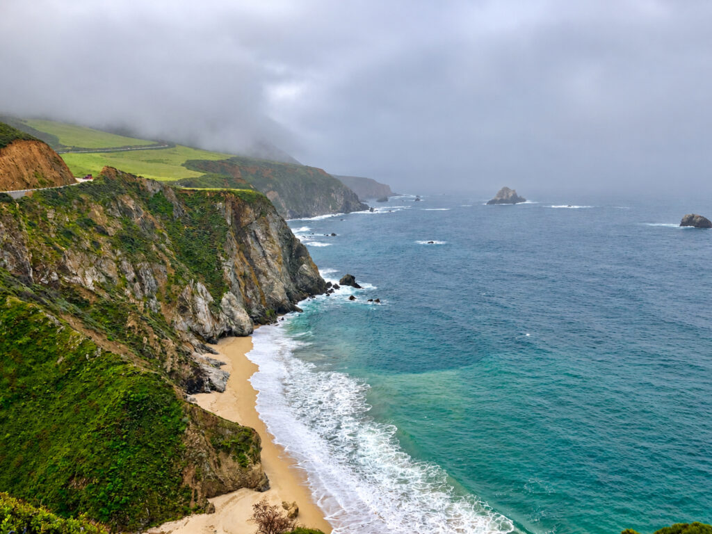
Big Sur is one of California’s most spectacular coastal destinations, known for its rugged cliffs, redwood forests, scenic beaches, and breathtaking views along Highway 1. However, the same dramatic landscape that makes Big Sur so beautiful can also make it vulnerable to flooding, landslides, and debris flows during severe winter storms.
Heavy rainfall can create hazardous driving conditions, particularly in areas affected by recent wildfires. Roads may close with little notice, hiking trails can become dangerous, and visitors may find themselves unable to reach certain destinations.
If you’re planning a trip to Big Sur during the rainy season, understanding these risks and checking current travel conditions can help you make safer decisions.
Is Highway 1 in Big Sur Open?
Highway 1 is the primary route through Big Sur, connecting the Monterey Peninsula and Carmel to the north with San Simeon, Cambria, and the Central Coast to the south.
Getting to Big Sur can be challenging during a storm. Although Highway 1 is generally accessible throughout much of the year, sections can temporarily close because of landslides, rockfalls, flooding, wildfire damage, or emergency repairs.
Before traveling to Big Sur, always check the latest Highway 1 road conditions. A closure in one section of Big Sur may prevent drivers from completing the entire coastal route, even when other portions of the highway remain accessible.
For current road conditions, visit:
- Caltrans QuickMap — Current highway closures, traffic incidents, and road conditions.
- Caltrans Highway 1 Road Information — Official state highway updates.
- Big Sur Chamber of Commerce Highway 1 Conditions — Local updates affecting travel along the Big Sur coast.
Travel Tip: If Highway 1 is closed between northern and southern Big Sur, travelers may need to use Highway 101 as an alternative route. Always verify that your intended destination remains accessible before leaving.
Why Is Big Sur Vulnerable to Flooding and Debris Flows?
Big Sur’s steep mountains rise dramatically above the Pacific Ocean, creating a landscape where heavy rainfall can quickly send water, rocks, mud, and vegetation downhill.
During intense storms, several hazards can affect the region.
Flash Flooding
Heavy rainfall can cause creeks and streams to rise rapidly, particularly in narrow canyons and low-lying areas. Floodwaters may cover roadways, damage bridges, and make river crossings dangerous.
Landslides and Rockfalls
Big Sur’s steep coastal slopes are naturally susceptible to erosion. Prolonged rainfall can destabilize hillsides, causing rocks, soil, and vegetation to fall onto Highway 1 and surrounding roads.
Debris Flows Following Wildfires
Areas affected by wildfires face additional risks because burned vegetation and damaged soil can reduce the landscape’s ability to absorb rainfall.
A debris flow is a fast-moving mixture of water, mud, rocks, and vegetation traveling downhill through canyons and drainage channels. Unlike ordinary flooding, debris flows can carry large rocks and other heavy materials, making them especially dangerous.
Even a relatively short period of intense rainfall can trigger a debris flow in recently burned areas.
How Do Wildfire Burn Scars Affect Big Sur?
Wildfires are part of Big Sur’s natural environment, but recently burned hillsides can remain vulnerable to erosion and debris flows long after the flames have been extinguished.
For example, the Timber Fire and Plaskett Fire in 2026 created additional concerns about flooding and debris flows along portions of the Big Sur coast.
In November 2026, Monterey County officials warned travelers to avoid Big Sur as a significant storm approached, citing concerns about potential debris flows in recently burned areas.
The warning demonstrated how wildfire damage can continue affecting travel conditions months after a fire.
Burn scar areas may remain vulnerable during subsequent rainy seasons, although the level of risk varies depending on vegetation recovery, soil conditions, and rainfall intensity.
Should You Travel to Big Sur During a Storm?
Generally, it’s best to postpone nonessential travel to Big Sur when significant storms, flash flood warnings, or debris flow advisories are in effect.
Light rain does not automatically make Big Sur unsafe. In fact, misty forests, flowing waterfalls, and dramatic coastal scenery can make rainy days particularly beautiful.
However, stronger storms can create rapidly changing conditions that make driving, hiking, and sightseeing hazardous.
Consider postponing your visit if:
- The National Weather Service has issued flash flood or debris flow warnings.
- Monterey County officials are advising against nonessential travel.
- Highway 1 is experiencing storm-related closures.
- Heavy rainfall is forecast near recent wildfire burn scars.
- Strong winds, falling rocks, or flooding could affect your planned activities.
Even when Highway 1 remains open, conditions along the coast can change quickly. Remember that an open highway does not necessarily mean every hiking trail, campground, beach, or scenic attraction is safe to visit.
What Should You Do If a Storm Is Forecast During Your Big Sur Trip?
If you’re planning to visit Big Sur and the forecast includes significant rainfall, a few precautions can make a meaningful difference.
- Check weather alerts before leaving. Review the National Weather Service forecast and any flash flood or debris flow advisories.
- Verify Highway 1 conditions. Check Caltrans QuickMap for closures, traffic restrictions, and alternative routes.
- Review park and trail closures. State parks, campgrounds, and hiking trails may close independently of Highway 1.
- Avoid hazardous areas. Stay away from flooded roads, steep unstable slopes, creek crossings, and recently burned canyons during storm warnings.
- Prepare for limited services. Cell service is unreliable in many parts of Big Sur, and road closures can make fuel, food, and lodging difficult to access.
Never drive through flooded roads, attempt to cross an active debris flow, or bypass a road closure. If authorities issue an evacuation warning or order, follow their instructions promptly.
When Is Big Sur’s Rainy Season?
Big Sur typically experiences most of its rainfall between November and April, with winter storms generally becoming more frequent from December through March.
These storms are an important part of the region’s natural environment, replenishing rivers, supporting redwood forests, and creating seasonal waterfalls.
However, winter visitors should be prepared for unpredictable weather, occasional road closures, and muddy or inaccessible hiking trails.
For travelers prioritizing scenic driving, hiking, and outdoor activities, the drier months generally offer more reliable conditions.
Where to Find Big Sur Weather Alerts and Road Closures
The following resources can help visitors stay informed before and during their trip.
| Resource | What to Check |
|---|---|
| Caltrans QuickMap | Highway 1 closures and traffic restrictions |
| National Weather Service | Rainfall forecasts, flood watches, and weather warnings |
| Ready Monterey County | Local emergency information and preparedness |
| California State Parks | Park, campground, and trail closures |
| Big Sur Chamber of Commerce | Highway 1 and local travel updates |
Frequently Asked Questions About Big Sur Storms
Is Highway 1 in Big Sur open year-round?
Highway 1 is generally open year-round, but storms, landslides, wildfires, and emergency repairs can cause temporary closures. Always check Caltrans before traveling, particularly during winter.
Is Big Sur safe to visit when it’s raining?
Light rain does not necessarily prevent a safe visit, but heavy storms can create hazardous road and trail conditions. Avoid unnecessary travel when flash flood warnings, debris flow alerts, or official travel advisories are in effect.
Can you drive through Big Sur during a storm?
Travel may remain possible during ordinary rainfall, but severe weather can make Highway 1 dangerous or inaccessible. Never attempt to drive through flooded sections or around official road closures.
What happens when Highway 1 closes?
Depending on the closure location, visitors may still be able to access some attractions from either the northern or southern entrance. However, driving the entire Big Sur coastline may not be possible, and Highway 101 may be required as an alternate route.
Are Big Sur hiking trails open after heavy rain?
Some trails may remain open, while others close because of flooding, damaged bridges, unstable slopes, or fallen trees. Check with California State Parks or the appropriate land management agency before hiking.
Final Thoughts: Plan Ahead and Travel Safely
Big Sur’s dramatic coastline is a remarkable place to explore in any season, but its mountainous terrain and exposure to Pacific storms make careful trip planning especially important during winter.
Flooding, landslides, and debris flows are natural hazards that can affect Highway 1, hiking trails, campgrounds, and local communities.
Before visiting, take a few minutes to review weather forecasts, road conditions, and official travel advisories. If a major storm is approaching, postponing your trip may be the safest choice.
Big Sur will still be there when the storm passes. A little flexibility can help ensure your visit is both memorable and safe.